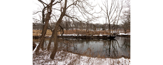
Have you ever wanted to stand with one foot on either side of a waterfall?
For most notable falls, that wouldn’t be possible without really long legs. But at the Mount Carmel Spring Falls, you can indeed span the thing. Its water burbles over the edge, down 76 feet of drops and rivulets into the more gushing Gorge Cascade.
Connecticut isn’t exactly known for its waterfalls, with geological circumstances creating rather squat mountain ranges and limiting the possibilities for watery spectacle. Officially, the highest is Roaring Brook Falls in Cheshire, at 80 feet. But the second-highest is just a 15-minute drive from downtown New Haven, on one of the edges of Sleeping Giant State Park.
Lots of rainy weather has meant that Sleeping Giant is packed with hikers and picnickers on nicer days. Even with three parking lots and street parking, it was hard to find a space near Giant’s main entrance at 200 Mount Carmel Avenue—but if you’re looking for the waterworks, that’s not necessarily where you want to be anyway.
Sure, you could hike it. It’s a two-mile trip from Mount Carmel Avenue, using a combination of the Violet and Circle trails that wends on an upward slope across much of the park. For the hiking-inclined, it’s a great way to see the Falls/Cascade and feel like you’ve earned it.
For the hiking-averse or time-crunched, an easier route exists. Driving northeast on Tuttle Avenue, past River Road, brings you much closer to the water. Before reaching Mansion Road, there’s a turn-off with space enough for just three cars. The day I went, the crowd at the Tuttle spot was a number of horses in the pasture across the way; two other cars in the tiny lot; and a rusty dissolving bus in the field over.
Despite no signage, waterfall-seekers are in the right place—a fact made more clear if you have a map. Sleeping Giant has more than 30 miles of trails, and here is where two of them—the Circle trail and the horseback riding trail—intersect. The water features are located along the former, its pathside trees marked by red circles. As for which direction to take, since a tall fall is the goal—and you can confirm it with that map—uphill is the way to go.
The passage inclines quickly, as a depression with a stream forms on the left. The stream, relatively slight during my visit, has managed to carve out the deep crevice through which it runs over thousands of years.
The trail itself is steep, with tree roots anchoring red sandstone turf. The roots form impromptu staircases at some junctures and rough tangles at others, but it’s only a short walk to the top, where the ground evens out.
The Spring Falls and Gorge Cascade extend below, the latter a gradual 25-foot drop of water leaping over mossy rocks on its way to the Mill River. Feeding the stream passed earlier, the waterfall and cascade are in turn fed by Sleeping Giant’s trapped snowmelt, as well as a share of the park’s rainwater and springwater.
As such, the falls and cascade show their best in the springtime. Taking the Circle Trail leads directly over the top, where a small footbridge spans the first drop. Water pours over the edge, streaming left and right but always down over rocky, brushy shelves on its 76-foot trip to the Gorge Cascade. Compared to the frenetic splashing of the cascade, the Falls have a quieter flow.
Other than than an intense jogger leaping over tree roots, the path to see the waterfall was quiet in general. This is clearly a less-trafficked part of Sleeping Giant. Most parkgoers are attracted to the picnic areas or the famous Tower Path, named for the observation tower (and stunning vistas) to which it leads.
But explorers of less worn tracks should seek the natural observation tower above Mount Carmel Spring Falls, whose delights are, well, more natural.
Mount Carmel Spring Falls & Gorge Cascade
at Sleeping Giant State Park
Falls Turn-off: 600 Tuttle Ave, Hamden (map)
Main Entrance: 200 Mount Carmel Ave, Hamden (map)
Daily 8am-sunset
www.ct.gov/deep/…
Written and photographed by Anne Ewbank.


